Distance: 78.1 miles (125.7 kms)
Total time: 8hrs32mins (including lunch stop)
Average Moving Speed: 12.3mph ( 19.8 kph)
Maximum Speed:37.1mph (59.7 kph)
Calories burned: 3536
Elevation gained: 2861 ft (meters)
Elevation gained: 2861 ft (meters)
Weather: After early morning fog, mostly sunny during the day and temperature rose to mid-high 80s (30-32C). A slight wind from the north and the humidity level was much more evident than yesterday. I sweated a lot on the climb.
Powered by: Breakfast - 2 bowls of Raisin Bran,waffle, yogurt, and fruit. Lunch of veggie sub, and snacks of 1 Clif bar, 1 McFlurry, 2 liters of Gatorade, I GU gel and 2 liters of water.


Like more days that I care to count, my plans for the day were waylaid by unexpected events. The morning was very foggy and I decided to wait for the sun to burn it off before starting out. As I left the hotel about 9am, I noticed that the front tire was flat. It must have been a slow leak because I did not notice it when I finished yesterday. After changing the tube and pumping it as high as I could, I headed for the local bike shop where the friendly proprietor chatted about the C&O trail and its hazards to bikes as I pumped the tire to its correct PSI. I noticed that most people on the trail are riding mountain bikes or hybrids, presumably because of the sharp stone objects and muddy parts. While I was irritated with the delay, I suppose it was the best place for the flat to occur and after all, this was the first flat in over 2000 miles.

Part of the C&O trail perched over the Potomac

A flashpoint in the Civil War because of the crossing here on the Potomac
I left the C&O at Williamsport to head for Gettysburg via Hagerstown. The trail was less muddy yesterday as the sun continues to dry out the wet spots left from the heavy rain on Friday. Williamsport was a pleasant surprise as the houses seem well looked after, and its history during the Civil War years reflects its important setting. As I headed north to climb over the last Appalachian ridge, I saw many historical markers that indicate the retreat from Gettysburg of the Confederates. The ridge was about a 600 ft climb and a grade of about 6%. It took a little bit to remind my legs that they needed to work a bit harder than on the perfectly flat trail of the previous 90 miles.
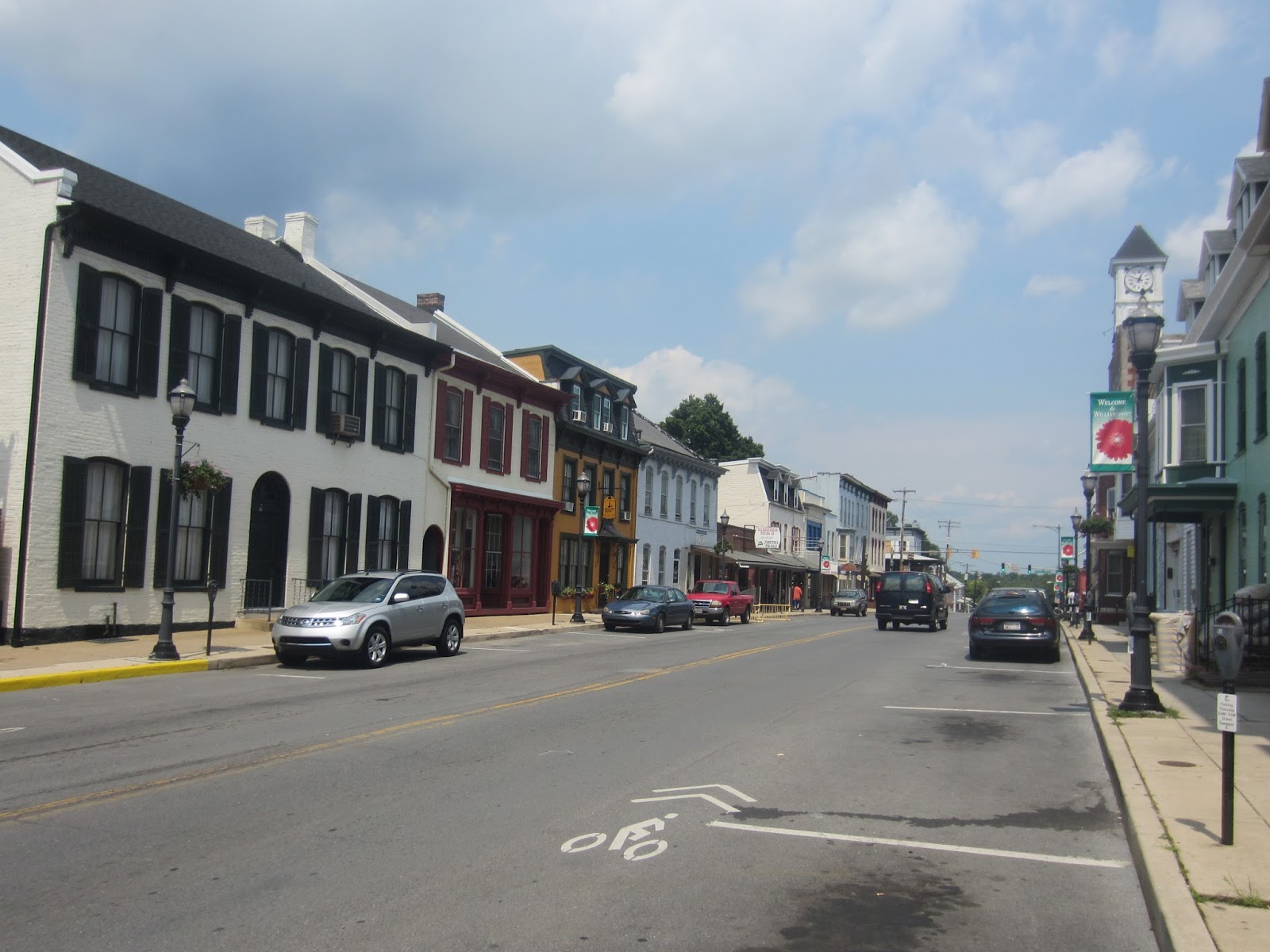
Downtown Williamsport, a nice place. The Confederate army crossed the Potomac here on their retreat from Gettysburg

There are many explanatory plaques like this one on the approach I took to Gettysburg which followed the route of the Confederate army retreat
I had been to Gettysburg once before when a graduate student at Penn State and I was curious to see if the site had changed. I had developed an interest in the Civil War as an undergraduate in Ireland as a visiting professor from the US taught a course in American history and piqued my interest in the subject, jaded as I was with the same European and Irish history material all the way from primary school. The same professor also sparked my interest in attending graduate school in the US. I was glad to see that the national historic park is exactly the same as I remembered it from over 40 years ago. While there has been some expansion of the tourist facilities in the park, and more guided tours than I remembered, its essential elements of memorials, plaques, landuse and roads are essentially unchanged. The town of Gettysburg has dramatically expanded with many more hotels, shops, restaurants and traffic than earlier.

Memorial to Lincoln's Gettysburg address at the cemetery

The Pennsylvania memorial is one of the biggest in the park

Memorial at the "high water mark of the Confederacy

Recent explanatory plaques in the park

Looking across the scene of Pickett's charge

Example of an older memorial in the park

Scene in the park at the sun was setting
No comments:
Post a Comment