Distance: 91.9 miles (147.8 kms)
Total time: 8hrs11mins (including lunch stop)
Average Moving Speed: 11.8mph (19.0 kph)
Maximum Speed:35.8mph (57.6 kph)
Calories burned: 5260
Elevation gained: 8118 ft (2474 meters)
Elevation gained: 8118 ft (2474 meters)
Weather: Absolute downpour with lightning at 8am in the morning and very misty and foggy after this. Temperatures never rose much above 75F (25C) but it still felt very steamy. Two more big downpours in the afternoon causing flooding of the streams and the roads had standing and flowing water. It remained very foggy and misty all day. Winds were light from the west.
Powered by: Big Breakfast - scrambled eggs, bowl of Raisin Bran, bagel, yogurt, fruit and a banana. Lunch of pizza, many healthy whole wheat Fig Newtons (Fig Rolls),1 liter of Gatorade, 1 Coke, I Gu gel, 1 Clif Bar, 2 bananas and 2 liters of water.


I expected some challenging days in this 'mad journey' but had few of them to this point. The worst was probably the hot day in eastern Washington when I had a flat, problems with a pump, and a long ride over humpty-dumpty hills to Lewiston ID. I had avoided bad weather - or rather, it had missed me, though the previous few days were uncomfortably humid. When it rained, I had the good fortune to be either in bed or within easy reach of shelter. My luck ran out today.
The forecast was spot on - for multiple thunderstorms during the day as a front pushed south-eastwards through the region. The humidity levels were at their maximum and the morning dawned grey, foggy, and then the skies opened. The thundershower delayed my departure which I knew was not a positive development since I had a long ride over many hills. A second major storm in the middle of the afternoon found me passing through small town so I was able to take shelter under a business awning. The third one caught me on the road, and after trying to shelter under some trees, I gave up as I was just getting slowly wet and got out into the downpour. Riding in heavy rain is not as bad as it sounds in the US in the summer since the air is warm and the kind of cold penetrating, often near-horizontal, rain that one finds in Ireland is unusual at this time of year. The biggest problem is going downhill because it's hard to see clearly at speed, the brakes might not work effectively, and the risk of skidding on a road that is covered by standing or flowing water is relatively high.
This does not look like a good start to a long biking day.

A downed tree from the overnight rain

A sign at the entrance to a well site

How would you like this in your backyard?
The first third of the ride to Waynesburg was dominated by a fracking environment, both in the heavy truck traffic on the road and the scarring of numerous hillsides by new access roads to the wells. I would not like to be a resident living in the houses which are passed by hundreds of heavy trucks a day, often in convoys of 4-7 trucks. Trucks come in all versions - fresh water, drilling, safety, power, cement, stone, equipment - but the incessant traffic would drive one batty. The lack of a shoulder (margin) only worsened the situation, as did the misty/foggy conditions. After Waynesburg, the fracking traffic disappeared (I think towards Uniontown) and I could concentrate on the task ahead.

The welcome sign almost got lost in the plethora of other signs

Rivers and streams are full with a lot of mud and debris even before the rain later in the day

It seems as if the Pennsylvania coal industry has come to a conclusion about US involvement in the Middle East

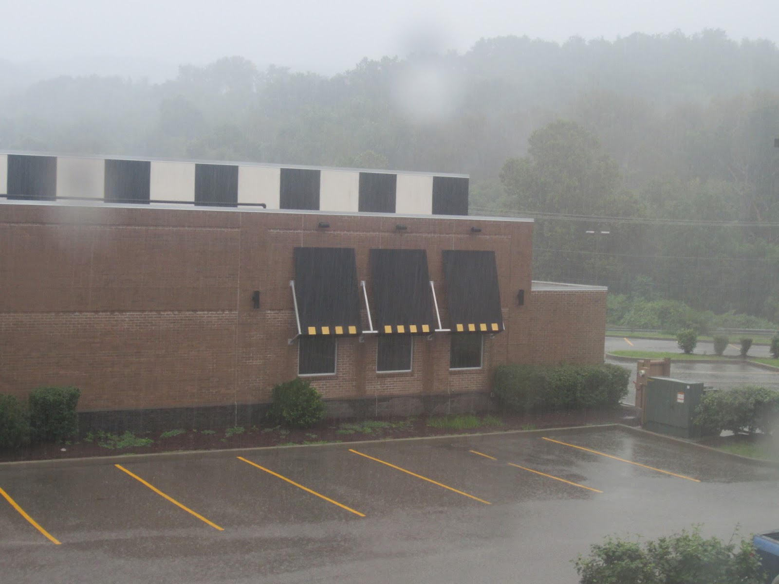
Sheltering from the second big rain storm of the day

Road flooding after the 3rd big rain storm

A new well at the top of a ridge which has now been scraped off
I was taking a bit of a gamble in relying on Google Maps to guide me in a south-easterly direction across the Laurel Highlands on local county roads and over one big climb. The lack of a cell phone signal to check on my position also added to my unease and the poor visibility due to the fog did not help. After negotiating some flooded roads, I headed into the climb which got very steep. My GPS recorded a grade of 17% at one point, though most of the climb (as is evident from the profile above) was in the 11-14% range for about 1400 feet (450 meters). The total climbing for the day was rhe highest yet at over 8000 feet (2500 meters).
I was now in a bit of a race against darkness as I still had 15-20miles to go to the hotel over unmarked local roads after the summit. Some friendly locals helped guide me - one couple offered dinner and another set of young people wanted me to join their very lively and loud party. At one particularly point of uncertainty at a crossroads, I waited for some drivers to come through so that I could ask for directions. The first woman looked at this apparition emerging from the fog and drove off at speed but thankfully, the second stopped at the urging of her children to direct me to the hotel. As darkness fell, I found a mini-mart, bought some pizza slices,and made it to the hotel, I could not understand why its rooms were all filled (though it is near an interchange) as it's in the middle of nowhere. But morning revealed the answer - across the road is the Federal Correctional Complex of Hazelton, WV - which has a high-security wing and currently, over 2100 inmates. So among the clientele at the hotel were many family members visiting the incarcerated across the way.

The road was gloomy, mist, foggy and steep in the ever encroaching darkness
No comments:
Post a Comment