Day 12 - July 13 - Helena, MT to White Sulphur Springs, MT - 76.6 miles ( 123.3 kms) - total so far: 922.0 miles (1489.6 kms)
Distance: 76.6miles (123,3 kms)
Total time: 6hrs49mins (including long lunch , chat with touring cyclists and a few photo opportunities) Distance: 76.6miles (123,3 kms)
Average Moving Speed: 14.3mph (23.0kph)
Maximum Speed:35.0mph (56.1 kph) Calories burned: 4065
Elevation gained: 3386 ft (1032meters)
Weather: Sunny and cool at first and sunny and warmer later from 56F (13C) in Helena to 78F (25C) in White Sulphur Springs. Quite windy all day with winds mostly from the north west in the morning and switching to the north east and becoming strong in the afternoon.
Powered by: 2 boiled eggs, 1 bowl of Raisin Bran, 1 bagel, and a doughnut for breakfast; 2 liters of Gatorade,2 liters of water, 1 Clif bar, 1 banana and a peanut butter bagel with a huge dollop of peanut butter (again very messy).


Powered by: 2 boiled eggs, 1 bowl of Raisin Bran, 1 bagel, and a doughnut for breakfast; 2 liters of Gatorade,2 liters of water, 1 Clif bar, 1 banana and a peanut butter bagel with a huge dollop of peanut butter (again very messy).


It was a day of contrasts, both in the landscape and in the weather. The changing winds especially marked the day; In the morning, I benefitted hugely from a strong tailwind from Helena to Townsendas I headed on rte 12 in a South-easterly direction. I met a couple on the road near Helena as they battled the wind heading to that city. They were on a tour from Florida to Oregon and basically planned to follow the route I have travelled to the coast. I had not seen bicyclist tourists since before Missoula so I was quite surprised to see them as we were not on a well-documented bicycle route. A couple of historical markers and crossing the Missouri river for the first time merited stops and pictures though I was traveling easily at over 23mph (37kph). The Missouri makes a great arc to the north before turning south east and I hope to cross it again in South Dakota in about a week.

I crossed the Big Belt Mountains later in the day.
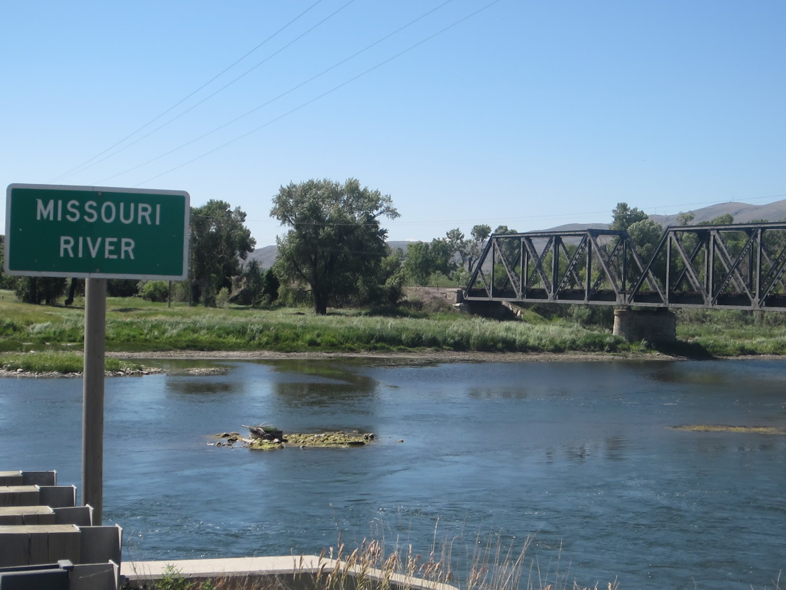
My first but not last sighting of the Missouri
Townsend was a farm service and tourist town as it's near a large lake and I saw a lot of boats being towed to it. After Townsend, the road climbed at a grade of about 3-4% for a long time before it entered the Helena National Forest. Here it narrowed considerably with no shoulder so I was glad that traffic was light. The canyon was narrow and the road and vegetation reminded me a lot of the Left Hand Canyon road to Jamestown near Boulder. The grade was steep enough at times and reached 6%.

Townsend's main street at lunchtime on Saturday

The road out of Townsend was a long grind

Nice road over the Big Belt mountains

Looks like the foothills near Boulder
Topping out at nearly 6000 ft, the vista opened up to my first experience of the "big sky" for which Montana is famous and is the state slogan. I could see my destination, White Sulphue Springs, about 20 miles away but getting there proved to be a struggle. Thought the road headed downhill, the uphill gusty winds from the Northeast slowed me considerably. Passing cars and trucks created huge wind drafts and many times, I felt as if the bike and me would topple over. On one long downhill, I tapped the brakes frequently as the road surface was recently laid down and was still quite rough, and the wind was definitely dangerously strong at speeds over 30mph. The last 10 miles was straight north into the teeth of the wind, which typically peaks around mid-afternoon in the foothills of the Rockies. It took me an hour. My arrival in White Sulphur Springs was greeted by a smell of rotten eggs from the spa hotel; supposedly, the waters here have the same composition as those of the famous spa in Germany, Baden-Baden. Having been to both locations, I suspect that the ratio of visitors in about 500 to 1 in favor of the German resort.

My first view of the "big sky" of central Montana
No comments:
Post a Comment