Start time: 10:30am
Total time: 7hrs45mins (stopping for chats, lunch, a lot of pictures, and fluids)
Distance: 63.6miles (102.4 kms)
Average Moving Speed: 13.1 mph ( 21.1 kph)
Maximum Speed: 33.6mph (54.1 kph)
Calories burned: 3797
Powered by: a large 3 egg asparagus-cheese breakfast scramble, potatoes and toast, a Subway 12" Veggie sandwich, an Eskimo pie (an ice cream sandwich), about 6 liters of water, 1 Coke, and 1 liter of Gatorade.
Elevation gained: 4590 feet (1399 meters)
Weather: Very sunny with strong NW wind; temperatures rose from 70F (21C) to 102F (39C).
Another late start due to some overdue emailing, small bike repairs (a water cage came off suddenly yesterday, luckily causing no damage) and chain cleaning and lubricating. I went back to the Historic Columbia highway, now a bike only trail out of Hood River for about 5 miles before joining the empty road later on. The views above the Columbia are spectacular, as is the preservation of the original highway structures (see the tunnels) and the signposting of the historic and scenic spots.
View of the Columbia from above on the bike trail; Interstate 84 is below
One of the original highway tunnels with the other in the background, beautifully preserved.
From the Rowena lookout point onto the original highway. It was fun to speed down these curves
I met a couple of bicyclists from Hood River and we rode fast to the lookout, where they turned back into the wind. I knew it would be windy when I saw the white caps on the Columbia when I awoke. After chatting for a while, I headed down to The Dalles on a switchbacked highway that reminded me of the corniches above Monte Carlo on the French Riviera, but without the crowds and traffic there.
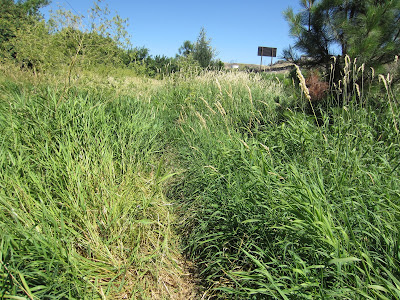
Farm track when the bike trail ended east of the The Dalles
I felt like Lewis or Clark at this point bushwhacking through the reeds.
Crossing into Washington state suggests that this sign about the character of the state is highly misleading, given the landscape here. One of the many local fireworks stands is visible on the left. Since the fire danger is so high, it's puzzling that the fireworks are so readily available.
Lewis and Clark took the easy route here by canoeing on the Columbia river below. But they missed the views.
Highway 14 has some spectacular buttes and great views of Mt Hood across the river behind me.Unfortunately, the heat haze hindered the view and photo. I was quite surprised by the number of wineries along this road.
The wind turbines were whirring - there are hundreds of them on this plateau overlooking the Gorge.
A longish stop at a convenience store for a Coke and ice cream before I tackled the last 10 miles (16kms) uphill to Goldendale into a headwind. A local doctor who is an avid bicyclist stopped to chat and to advise me about roads, traffic, grades, and sights of the region. He warned me about the climb to Goldendale and he was correct. The grades kicked up to 10% and the wind was strongly in my face. I was passed by lots of trucks with flashing emergency lights as they grinded their way slowly uphill through the gears. I just put my head down and pedalled away, not bothering to check the speed which was in the single digits - probably 8mph (13 kph). I'm glad that I stopped for the Coke and ice cream as the last climb was 900 feet (300 meters).


I'm sure that the Dr. would also consent to a doubling of your daily intake of eskimo pies, a much-needed supplement for cross-country bike trips.
ReplyDeleteTowering wind turbines are destroying the physical sense of place in many parts of the world. I'm tired of them being given a green light out of political-correctness. Once you dig into their downsides (including highly intermittent power) you can see industry propaganda for what it is.
ReplyDelete